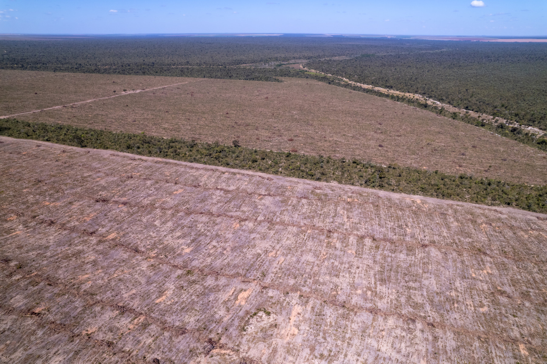
Experts use AI and satellite images to reveal vast damage to critical Amazon buffer zone
An international team of scientists has used artificial intelligence and 35 years of satellite data to uncover the shocking scale of environmental destruction in one of the world鈥檚 most important ecosystems.
The research, published in Biological Conservation, found that more than 493,000 square kilometres of land - an area larger than Spain - has been damaged by deforestation and fires in the vital transition zone between the Amazon rainforest and the Cerrado savanna in Brazil.
The team - led by Dr Chuanze Li from The University of Manchester - say the findings reveal a major conservation crisis in a region that helps protect the wider Amazon, stores huge amounts of carbon and supports exceptional biodiversity but has very little formal protection.
Key findings
Researchers mapped more than 35 years of environmental damage using AI and satellite imagery
At least 493,000 km虏 of land has been affected by deforestation or fire
Large areas damaged by fire still had not recovered even after a decade
Only around 2% of the study region currently has formal protection
Repeated human-caused fires may be permanently changing ecosystems
What did the study find?
The research focused on the Cerrado-Amazon transition (CAT) zone in Brazil, a vast area where rainforest and savanna meet.
Using decades of Landsat satellite images combined with artificial intelligence, researchers tracked how forests and vegetation changed between 1986 and 2020.
They found widespread damage caused by both large-scale forest clearing and repeated fires linked to farming expansion and cattle ranching.
Why this region matters
This area is one of the world鈥檚 most important ecological frontiers, and acts as a buffer protecting the Amazon while supporting unique wildlife and storing carbon that would otherwise contribute to climate change if released.
But despite its importance, the region has received far less attention and protection than the Amazon rainforest itself.
Fires leave long-lasting scars
One of the study鈥檚 most striking findings was how slowly vegetation recovered after fire. Researchers found that even ten years later, many affected areas had still not returned to their previous condition.
The damage was particularly severe in parts of the Cerrado, where repeated human-driven burning appears to be weakening the ecosystem鈥檚 natural ability to recover.
A hidden protection gap
The study also exposed a major lack of protected areas across the region. While around 28% of the Amazon biome overall is protected, only around 2% of the Cerrado鈥揂mazon transition area studied falls within protected zones.
Researchers warn that large areas facing repeated destruction currently have little or no legal safeguard.
How AI helped uncover the damage
The team combined satellite imagery with advanced artificial intelligence tools capable of detecting different types of environmental disturbance over time.
This allowed researchers to distinguish between forest clearing and fire damage across an enormous area spanning more than one million square kilometres.
What the 91直播 researchers said
鈥淭he tools we used enabled us to produce the first wall-to-wall, multi-decade picture of what has actually happened to vegetation across this entire area,鈥� said lead author Dr Chuanze Li.
We found damage on a vast scale, but sadly we also found that many ecosystems are struggling to recover even years later.
鈥淲e were particularly struck by the recovery data,鈥� said Dr Angela Harris. 鈥淭he conventional view is that Cerrado vegetation bounces back after fire. What this study shows - at a regional scale and across 35 years - is that it often does not, at least not within a decade.鈥�
"Repeated fires are eroding the very resilience these ecosystems evolved to have - this is a warning that we cannot ignore."
"This study gives policymakers something they have not had before: a precise, long-term map of where the CAT has been damaged, how badly, and how well, or how poorly, it is recovering,鈥� added Dr Polyanna da Concei莽茫o Bispo. 鈥淭his is the empirical foundation that conservation planning in this region has been missing. The protection gap we document is not acceptable, and the tools now exist to close it."
Why it matters
Researchers say the maps created by the study could help governments and conservation groups identify areas most urgently in need of protection, fire prevention and restoration.
They also warn that continued destruction in the transition zone could have consequences far beyond Brazil, affecting biodiversity, climate stability and the future health of the Amazon rainforest itself.
Publication details
The study was conducted by researchers at The University of Manchester (UK), 聽Professor Beatriz Marimon and Professor Ben Hur Marimon at UNEMAT 鈥� Universidade do Estado de Mato Grosso (Brazil), and Dr. Ricardo da Silva at CTREES (USA). Field data from the Plant Ecology Laboratory at UNEMAT, a reference network spanning the CAT since 1994, underpinned the classification and validation of satellite-derived disturbance maps.
The paper was published in the Biological Conservation journal.
DOI: